Punta Rafalera
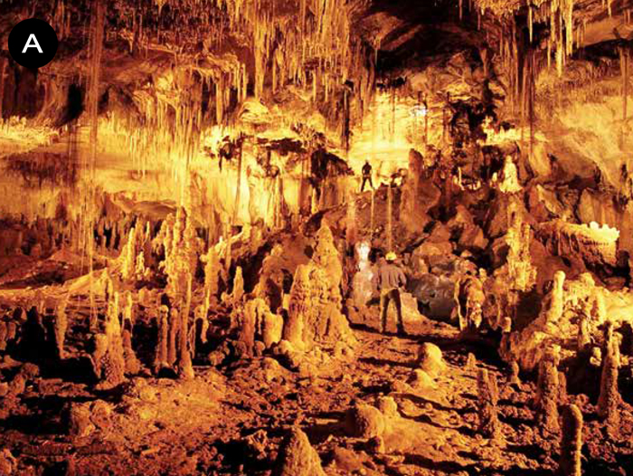
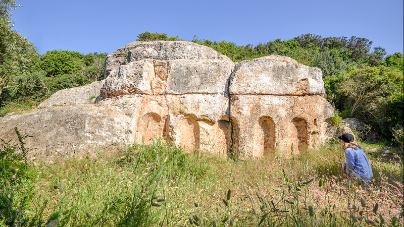
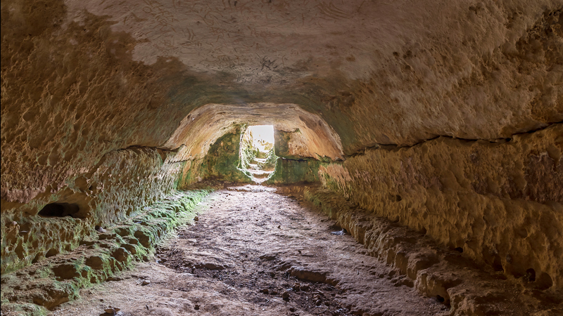
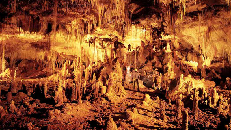
A. COVES DE PERELLA
Les extenses urbanitzacions turístiques i residencials de Cala Blanca i Son Carrió es desenvolupen als voltants de les platgetes de cala Blanca i Santandria. És una zona que forma part de la plataforma de calcarenites miocèniques que constitueixen la zona geològica del sud de l’illa i presenta un subsòl molt ric en formacions càrstiques, és a dir, amb cavitats produïdes per l’acció erosiva de l’aigua. Se sap que algunes de les coves van ser freqüentades en l’època prehistòrica i que foren visitades amb regularitat al llarg de la història. En els segles xviii i xix les coves de Perella, com es coneixen, esdevingueren una visita obligada per la seva bellesa geològica. Avui dia no estan obertes al públic, però l’Administració insular vol condicionar-les com un atractiu turístic més de la zona.
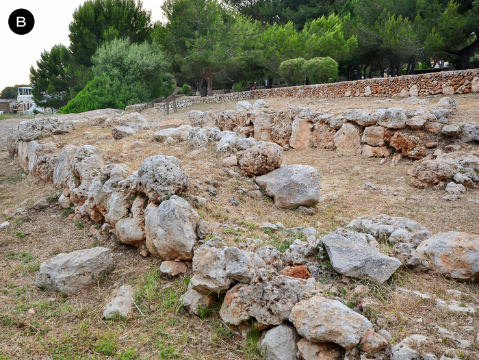
B. NAVETA DE CALA BLANCA
En un costat de la cala hi ha les restes, molt malmeses per la urbanització, d’una casa construïda fa més de tres mil anys, en l’època naviforme, entre el 1600 i el 1000 aC aproximadament. Aquest tipus de construcció es coneix com naveta d’habitació o naviforme, tenia planta de ferradura allargada, murs de pedra i coberta de material vegetal. Els naviformes eren possiblement habitatges unifamiliars. A la part davantera hi treballaven i hi cuinaven, mentre que la part interior es destinava al descans i a l’emmagatzematge d’aliments i utillatge domèstic. L’economia dels pobladors de l’illa d’aquesta època es basava en l’agricultura i la ramaderia, i quasi no consumien peix ni mol·luscs. Era una societat autosuficient i poc o gens jerarquitzada.
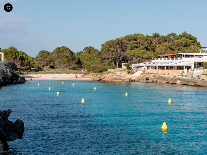
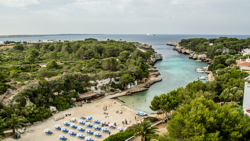
C CALA BLANCA
En la cartografia francesa del segle xviii aquesta platgeta apareix amb el nom de Cala Fontaine, per una font d’aigua dolça que brolla dins les aigües de la cala. La fredor de l’aigua dolça que surt de les entranyes de la roca de la ribera septentrional és clarament perceptible quan ens submergim en el mar. El topònim de cala Blanca li deu venir del color blanc nivi de l’arena i de l’important sistema dunar que antany hi havia als voltants. Òbviament aquestes dunes es reduïren considerablement amb la urbanització dels terrenys que l’envolten. Disposa de serveis i establiments hotelers i de restauració durant la temporada turística, de maig a octubre. Al pinar hi ha una zona verda amb un parc infantil, i s’hi pot accedir tot
l’any amb transport públic.
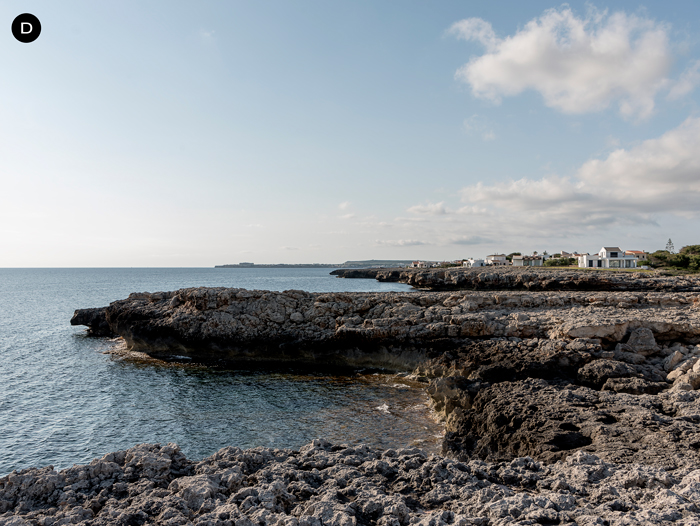
D. CAP DE SA PARET I PUNTA DE S’AIGUA DOLÇA
Aquí podrem gaudir d’unes fantàstiques postes de sol en el Canal de Menorca, amb la silueta de l’illa de Mallorca al fons. Aquest escull costaner fou durant l’època andalusina de Menorca (segles x a xiii) una pedrera de la qual s’extreien pedres de molins manuals per a l’obtenció domèstica de farina de cereals o lleguminoses, i que també es feien servir com a tapadores de sitjots. Des d’aquí serien traslladades a les cales adjacents i als llocs de venda o es carregarien en vaixells per a l’exportació. Des d’aquest punt, i vorejant la costa més enllà de la urbanització, entrarem en una àrea natural d’especial interès, que podem recórrer a peu tot seguint el Camí de Cavalls. Passats uns quants quilòmetres arribarem a les urbanitzacions de Cap d’Artrutx, Cala en Bosc i Son Xoriguer, a la costa sud.
A. PERELLA CAVES
The extensive tourist and residential developments of Cala Blanca and Son Carrió have grown up around the beaches of Cala Blanca and Santandria. This area is part of the Miocene calcarenite platform that forms the geological area of the south of the island, and its subsoil is very rich in karstic formations, in other words, cavities produced by the erosive action of water. It is known that some of the caves were frequented in the prehistoric era and that they have been visited regularly throughout history. In the eighteenth and nineteenth centuries, a trip to the Perella caves, as they are known, was a must for visitors because of their geological beauty. They are not now open to the public, although the island’s authorities plan to prepare them as another tourist attraction in the area.
B. NAVETA OF CALA BLANCA
On one side of the cove are the remains, somewhat damaged by the development, of a house built over three thousand years ago, in the Naviform period, between 1600 and 1000 BC approximately. This type of structure is known as a naveta
or naviform dwelling. It had a lengthened-horseshoe floor plan, stone walls and a roof made of plant material. Naviforms were possibly homes for a single family. They would work and cook in the front, while the inner part was used for sleeping and storing food and household utensils. The economy of the island’s inhabitants in that time was based on agriculture and livestock, and they hardly consumed any fish or molluscs. It was a self-sufficient society with little or no hierarchy.
C. CALA BLANCA
This small beach is called Cala Fontaine on eighteenth-century French maps because of a fresh-water spring which flows out of the rock into the water of the cove. The coolness of the fresh water which flows from deep within the rock of the northern bank can clearly be felt when you get into the sea. The name Cala Blanca comes from the snowy white colour of its sand and the important dune system that once surrounded it. These dunes have obviously shrunk considerably with the development of the surrounding land. It has services and hotel and restaurant establishments during the tourist season, from May to October. In the pine grove there is a green space with a children’s playground, and it can be reached on public transport all-year round.
D.CAP DE SA PARET AND PUNTA DE S’AIGUA DOLÇA
Here you can enjoy wonderful sunsets in the Menorca Channel, with the silhouette of the island of Mallorca as a backdrop. During the period of Muslim rule in Menorca (from the tenth to the thirteenth centuries), this rocky part of the coast was a quarry from which stones for hand-mills for domestic grinding of flour from cereals or legumes were extracted as well as covers for silos. From here they were taken to the adjoining coves and to the places where they were sold or were loaded onto boats for export. From this point, skirting the coast past the development, you enter a Natural Area of Special Interest (ANEI), which you can walk through, following the Camí de Cavalls. After a few kilometres you come to the developments of Cap d’Artrutx, Cala en Bosc and Son Xoriguer, on the south coast.